- Home Page /
- Books /
- Travel Books, Maps & Guides /
- Shop Travel Books, Maps & Guides by Interest /
- Parks & Campgrounds Travel Books, Maps & Guides /
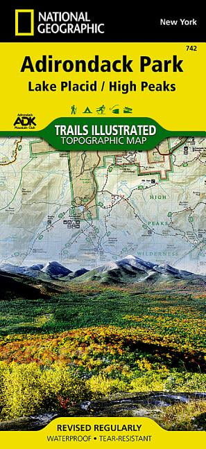
- National geographic maps: trails illustrated:...
0 ratings

Item #:
167410964
National geographic maps: trails illustrated: lake placid, high peaks: adirondack park - folded map: 9781566953573
Item #:
167410964
SCR 403
Price Details
Excluding Shipping & Custom charges ( Shipping and custom charges will be calculated on checkout )
*All items will import from US
0 ratings
Write a review
In stock
 Imported from USA store
QTY:
Order now and get it around Tuesday, July 28
Secured transaction
Ubuy works hard to protect your security and privacy. Our advanced payment security system ensures confidentiality by encrypting your information during transmission using AES (Advanced Encryption Standards) and SSL (Secure Socket Layer) protocols. Your payment details are 100% secure as we do not share your payment details with third party sellers.
Our Top Logistics Partners


National Geographic's Trails Illustrated map of Adirondack Park combines unmatched detail with helpful information to offer an invaluable tool for making the most of your visit to this extraordinary region.

Fast
Shipping

Free
Return*

Secure Packaging

100% Original Products

PCI DSS Compliance

ISO 27001 Certified


Note: Step Down Voltage Transformer required for using electronics products of US store (110-120). Recommended power converters Buy Now.


What Stands Out
Detailed Topography
Features intricate topographical details of Lake Placid and the High Peaks, enabling hikers to navigate complex trails effortlessly and explore the stunning Adirondack Park.
Durable Material
Printed on high-quality, tear-resistant paper, this folded map withstands outdoor conditions, ensuring longevity and reliability during your adventurous explorations in the wilderness.
Safety and Navigation
Includes vital information such as trail difficulty, distance, and safety tips, empowering users to plan and enjoy their trips while minimizing risks in the challenging terrain of Adirondack Park.
Product Details
Dangerous Goods
To avoid the delay in customs clearance process for Dangerous Goods, the shipment shall be opened at our warehouse facility to check the severity of hazardous components. Please see the list of Dangerous goods here.
Who Should Buy?

-
Outdoor Enthusiasts
Perfect for hikers and campers exploring the scenic trails in the Adirondack Park and surrounding areas.
-
Tourists
Ideal for visitors to Lake Placid who want to navigate and discover local attractions and natural wonders.
-
Nature Lovers
Great for anyone interested in wildlife observation and outdoor photography in the beautiful Adirondack region.

-
Urban Explorers
Less useful for those more interested in city navigation rather than rural or wilderness areas.
-
Digital Navigation Users
Not suitable for individuals who prefer digital maps or GPS devices over traditional paper maps.
-
Frequent Travelers
Not ideal for those who travel frequently to different locations and need more versatile mapping solutions.
Product Description
National geographic maps: trails illustrated: lake placid, high peaks: adirondack park - folded map: 9781566953573
Have any Query? Chat with us
Customer Questions & Answers
-
Question:
Is the map waterproof?
Answer: Yes, the Trails Illustrated map is printed on waterproof and tear-resistant paper. -
Question:
What activities can I use this map for?
Answer: The map is suitable for hiking, horseback riding, biking, snowshoeing, cross-country skiing, and snowmobiling. -
Question:
What is the scale of the map?
Answer: The map scale is 1:75,000.
National Geographic Maps Parks & Campgrounds Travel Books, Maps & Guides Editorial Review
No editorial reviews found
Customer Reviews & Ratings
1 customers ratings
-
5 Star
100%
-
4 Star
0%
-
3 Star
0%
-
2 Star
0%
-
1 Star
0%
Review this product
Share your thoughts with other customers
Platform Trust & Buyer Confidence

MT
Mohd
Verified buyer
“The product received very good packaging & safe…Thank You”
16 June 2026 · via Trustpilot
SJ
Shawati
Verified buyer
“Accurate delivery timing given”
16 June 2026 · via Trustpilot
YB
Youcef
Verified buyer
“Not madly expensive like I thought, and much quicker than promised.”
15 June 2026 · via Trustpilot
LM
Leila
Verified buyer
“Never dealt with Ubuy before, but everything worked out great. Seamless cross border purchasing and shipping. Thanks!”
6/7/2026 · via Trustpilot
KA
Kwame
Verified buyer
“The process was smooth, with clear communication and timelines. This was my 1st purchase and I am really impressed. I will definitely be coming back.”
12 June 2026 · via Trustpilot
Secure Checkout
Global Delivery
Easy Returns
Genuine Products
Product Price History
Important information
- Limitations : For products shipped internationally, please note that any manufacturer warranty may not be valid; manufacturer service options may not be available; product manuals, instructions, and safety warnings may not be in destination country languages; the products (and accompanying materials) may not be designed in accordance with destination country standards, specifications, and labeling requirements; and the products may not conform to destination country voltage and other electrical standards (requiring use of an adapter or converter if appropriate). The recipient is responsible for assuring that the product can be lawfully imported to the destination country. When ordering from Ubuy or its affiliates, the recipient is the importer of record and must comply with all laws and regulations of the destination country.
- Not all the products listed on Ubuy are for sale, as Ubuy is a global search engine. Products are subject to export/trade regulations.
SCR 403
Order now and get it around Tuesday, July 28
This item is not restrict in my country.(Please click on above link if this item is not restrict in your country, So our team will review and allow.)
QTY:
Secured transaction
PCI DSS compliant and ISO 27001:2022 certified, with encrypted payments and full buyer protection on every order.
Our Top Logistics Partners
Fastest cross-border delivery
Features & Benefits
- Unmatched detail of Adirondack Park's diverse landscapes.
- Expertly researched in partnership with local land management agencies.
- Features a comprehensive High Peaks Trail Chart for various activities.
- Printed on waterproof and tear-resistant Backcountry Tough paper.
- Includes essential recreational features like campgrounds and trailheads.
- Perfect for hiking, biking, snowshoeing, and more.
Ubuy Assurance
Experience worry-free shopping with 100% original products, PCI DSS-compliant payment security, ISO 27001-certified data protection, the fastest cross-border delivery, free returns *, and secure packaging on every order.